
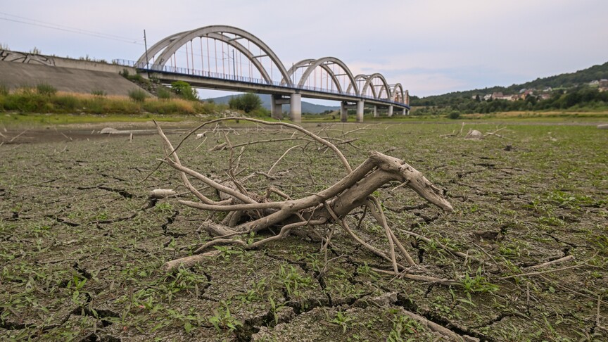
A rapidly strengthening El Nino is raising the prospect of a historic climate event later this year, potentially reshaping weather patterns across much of the world and bringing heightened risks of drought, flooding, extreme heat and wildfires.
After months of forecasts pointing toward a powerful El Nino, the latest projections have become even more striking.
In early June, the World Meteorological Organization (WMO) said there was an 80% chance of El Nino developing between June and August, with the probability of the phenomenon persisting through at least November reaching around 90%.
The agency said forecast models pointed to at least a moderate event and possibly a strong one.
The US National Oceanic and Atmospheric Administration (NOAA) at the time put the chance of a very strong El Nino developing later in 2026 or early 2027 at 63%.
But in its mid-August update, NOAA said El Nino was already present and strengthening, with more than a 90% chance of a very strong event during the Northern Hemisphere fall and winter of 2026-27.
More strikingly, NOAA gave a 69% chance that the October-December period will see a “historic” El Nino event, that would exceed the strength of previous events dating back to 1950.
Paul Roundy, a professor of atmospheric and environmental sciences at the State University of New York at Albany, said the warning signs have been building for months, with the developing event repeatedly exceeding expectations.
“Beginning in April, this event was already exceeding most observed past events,” Roundy told Anadolu.
He noted that numerical models were already pointing toward a strong event at the time, but the developing El Nino repeatedly grew stronger than earlier forecasts had suggested.
It also achieved more east Pacific warm-water volume than any El Nino since 1950 and potentially much further back in the historical record, he said.
“I think 69% is conservative, given that the event has already exceeded the intensities of the strongest events of the 20th century by the best measures we have,” Roundy said.
The remaining uncertainty, he added, largely concerns how strongly those signals will persist through the Northern Hemisphere winter.
“At this time, confidence levels for a seasonal forecast are probably higher than we've seen in more than a lifetime,” Roundy added.
El Nino is a naturally occurring climate pattern driven by unusually warm sea surface temperatures in the central and eastern tropical Pacific Ocean.
Under normal conditions, trade winds blow westward along the equator, pushing warm surface water toward Asia and Australia. At the same time, colder, nutrient-rich water rises from the depths near South America in a process known as upwelling.
During El Nino, those wind patterns weaken or reverse, allowing warm ocean water that normally remains in the western Pacific near Asia to spread eastward toward the Americas.
The warmer ocean then changes the transfer of heat and moisture to the atmosphere, altering atmospheric circulation and, ultimately, weather patterns around the world.
NOAA's latest assessment indicates a strengthening event. Sea surface anomalies in the eastern equatorial Pacific exceeded 2C (35.6F) in July, while subsurface temperature anomalies reached as high as 10C (50F) at depth.
Westerly wind anomalies have also emerged across the western and east-central equatorial Pacific, accompanied by enhanced rainfall over the central and eastern Pacific and suppressed rainfall over Indonesia.
El Nino occurs every two to seven years on average and typically lasts between nine and 12 months.
Its effects are not just confined to the atmosphere. By weakening the upward movement of nutrient-rich deep ocean water, known as upwelling, El Nino can disrupt phytoplankton and marine food webs.
“The peak intensity is strongly constrained by the seasonal cycle, to between November and January,” Roundy said.
He, however, warned that “peak impacts” could extend through the end of northern winter and into spring 2027.
“Some past events have extended even into summer, but the ending time is highly uncertain because it depends on wind events,” he added.
NOAA's forecast of a very strong El Nino during the Northern Hemisphere fall and winter of 2026-27 is consistent with Roundy's assessment.
NOAA also expects El Nino conditions to persist through the Northern Hemisphere spring 2027.
El Nino does not produce one uniform type of weather. Instead, it shifts atmospheric circulation in ways that can make some regions wetter while leaving others unusually dry.
“High rainfall rates over the equatorial east Pacific region” would drive atmospheric circulation responses around the world, Roundy said.
Indonesia and the lower Amazon could face drought and an increased risk of forest fires while northern and eastern Australia and India could also experience unusually dry conditions.
Other regions could face the opposite problem.
Roundy expects plentiful rainfall in Northeast Africa between September and December — conditions that would generally benefit agriculture — as well as ample rainfall in Argentina.
In the US, he expects potentially very heavy rainfall, “possibly historic levels,” in California and parts of the southern US during December-February.
Wetter conditions could also reach the US Atlantic coast, while areas stretching from Washington state eastward toward Minnesota could be drier.
Roundy also expects a warmer winter across the northern and northeastern US.
Meanwhile, NOAA cautions that even with an event of historic magnitude, “the chances of experiencing impacts consistent with El Nino are larger, but they are not guaranteed.”
The emergence of an exceptionally powerful El Nino comes against a very different climatic backdrop from many previous events, with human-caused climate change having already raised global ocean temperatures.
Roundy said that warming could both strengthen and temper different aspects of El Nino's influence.
“Climate change has warmed the west Pacific source water, allowing the event to get a little stronger,” he underscored.
But warming has not been confined to the region that fuels El Nino. The broader warming of the oceans also reduces the temperature contrast between El Nino's tropical waters and the middle latitudes and other parts of the tropics, Roundy explained.
“Climate change likely works in both directions, increasing impacts by increasing temperature of the El Nino source water, but reducing impacts by reducing contrast in temperature,” he added.
This is why some oceanographers have begun using a relative ENSO index “which weakens the apparent signal relative to the normal El Nino indexes,” Roundy further said.
“But the event is still huge, even in those indexes,” he said.
Meanwhile, Roundy offered an optimistic assessment of the potential historic event.
“The world is now better prepared to handle the impacts of extreme El Nino events than in the past,” he said.
news_share_descriptionsubscription_contact

contact_the_ombudsman
is_there_an_error_in_this_story