Halis Sünnetci
04 September 2026•Update: 05 September 2026
The UN General Assembly adopted a non-binding resolution promoting world maps that more accurately reflect the relative sizes of countries and continents, with 164 member states voting in favor, six abstaining and the US voting against.
The “Correct the Map” resolution, put forward by African Union member states and the Bahamas, calls for more equitable cartographic representations of the world, particularly Africa.
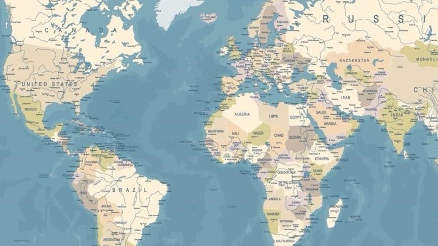
The resolution argues that disproportionate representations, particularly those resulting from the Mercator projection, have had lasting cognitive, educational, cultural, geopolitical and socioeconomic effects, contributing to a ‘symbolic minimization’ of Africa and other regions in the global collective imagination.
The Mercator projection was created by Flemish cartographer Gerardus Mercator in 1569. Its scale increasingly exaggerates the size of land masses farther from the equator. Greenland, for example, can appear roughly comparable in size to Africa on Mercator maps, although Africa is about 14 times larger.
Critics of the Mercator projection have described it as Eurocentric, arguing that its exaggerated depiction of Europe and other regions in the Northern Hemisphere reinforces perceptions of Western superiority. Some have referred to the effect as ‘cartographic colonialism.’
The resolution promotes the Equal Earth projection, introduced in 2018, which more accurately represents the relative surface areas of countries and continents, providing a clearer picture of their sizes in relation to one another.
The measure also urges governments, international organizations, educational institutions and other stakeholders to promote equal-area maps and encourages technology platforms to engage with UN member states and regional organizations on their use.
The vote follows a campaign led by African countries to change how the continent is represented on commonly used world maps. The African Union previously endorsed the Correct the Map initiative, arguing that the Mercator projection has contributed to misconceptions about Africa’s geographical scale.
The resolution is non-binding and does not prohibit the use of the Mercator projection.